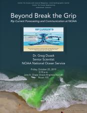
Beyond Break the Grip: Rip Current Forecasting and Communication at NOAA
NOAA National Ocean Service
Rip currents are the greatest public safety risk at the beach and cause an estimated 100 drownings each year in the U.S. Over the past two decades, NOAA has led efforts to increase public awareness about these hazardous, fast-moving surf zone currents. The well-known “Break the Grip of the Rip!®” campaign has shown evidence of successfully conveying to beachgoers the “swim parallel” strategy to escape a rip current. This evidence suggests that more people than ever before are generally aware of the dangers rip currents pose, and what to do if caught in one. Despite these successes, there remains a public knowledge gap regarding what one can do to avoid being caught in a potentially life-threatening rip current in the first place. There are several ongoing efforts at NOAA with the aim to reduce this knowledge gap. A statistical rip current model, which provides an hourly 6-day forecast of the likelihood of hazardous rip currents every kilometer along shore, is being implemented into NOAA operations in time for the 2020 beach season. Web cams are being used to detect rip currents and aid in forecast model validation. Social science researchers have investigated how to communicate this rip current forecast to the public and how to enhance the preparedness and prevention aspects of rip current messaging. New videos, signage and other outreach material have been developed using the most recent social and physical science research on rip currents to be more effective. Through these efforts, NOAA continues to increase rip current awareness with the goal of reducing rescues and drownings.
Greg is a physical oceanographer and the Chief Scientist for the National Ocean Service (NOS) Center for Operational Oceanographic Products and Services (CO-OPS). His research focuses on coastal oceanographic product development through the intersection of data science with coastal hazards. Greg has been at CO-OPS for nearly 8 years. Prior to serving as Chief Scientist, Greg was an oceanographer on the currents team where he led a range of physical oceanographic projects. Notable projects include a large-scale, multi-year current survey of Puget Sound where over 130 current profilers were deployed; the development of a High Frequency Radar Surface Current web product; and the creation and operational transition of the NOAA rip current forecast model. Prior to joining NOAA, Greg completed his Ph.D. in physical oceanography at the University of North Carolina Chapel Hill where he studied coastal processes and rip currents.


