You are here
Using Multibeam Echosounders for Hydrographic Surveying in the Water Column: Estimating Wreck Least Depths
CCOM/JHC
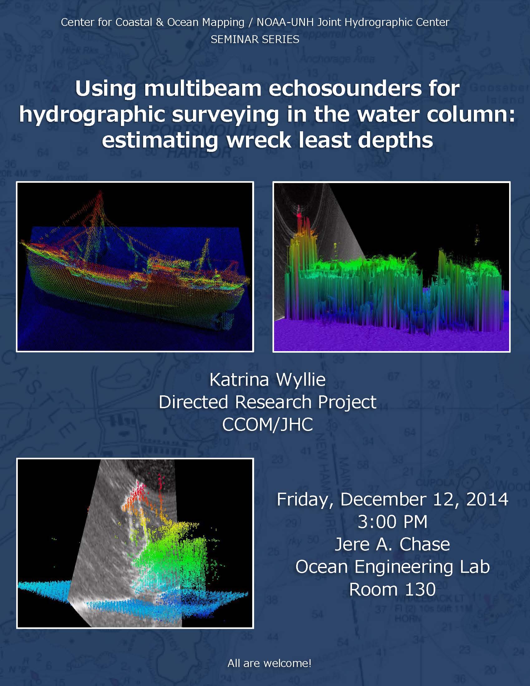
Wreck superstructure can extend into the water column and pose a danger to navigation if the least depth is not accurately portrayed to mariners. NOAA has several methods available to acquire a wreck least depth: lead line, wire drag, diver investigation, side scan shadow length, single beam bathymetry, and multibeam bathymetry. Previous studies have demonstrated that the multibeam bottom detection algorithm can fail to locate a wreck mast that is evident in the water column data.
Modern multibeam sonars can record water column data in addition to bottom detections. NOAA’s current Hydrographic Specifications do not require water column collection; the best practice is to collect additional bathymetry data during wreck developments. Several multibeam bathymetry and multibeam water column datasets collected by NOAA vessels are evaluated and the wreck least depth results are compared to previous international field trials. A workflow to extract filtered and sidelobe suppressed water column point clouds is presented using currently available software packages. This paper explores the challenges encountered with water column data collection and processing and finds that analysis of water column data provides an improvement to finding wreck least depths, in some cases.
Katrina Wyllie graduated from the College of Charleston in December 2008 with a B.S. in Marine Biology. From 2009 to 2013, Katrina worked at NOAA’s Atlantic Hydrographic Branch in Norfolk, VA where she focused on quality assessment reviews of hydrographic surveys, generated nautical chart products, and assisted on hydrographic vessels. Currently, Katrina is pursuing a M.S. in Earth Sciences Ocean Mapping from University of New Hampshire before returning to NOAA’s Operations Branch in Silver Spring, MD as a Physical Scientist.


