-
Jan24
 3:10pm - 4:10pm, Katherine Adler, Ph.D.
-
Jan31
 3:10pm - 4:10pm, Maricarmen Guerra Paris, Ph.D.
-
Feb7
 3:10pm - 4:10pm, Kaelyn Gamel, Ph.D.
-
Feb14
 3:10pm - 4:10pm, Jeonghwa Seo, Ph.D.
-
Feb21
 3:10pm - 4:10pm, Luciano Fonseca, Ph.D.
-
Feb28
 3:10pm - 4:10pm, Mario Conde Frias
-
Mar7
 3:10pm - 4:10pm, Yuri Rzhanov
-
Mar28
 3:10pm - 4:10pm, Longhuan Zhu
-
Apr4
 3:10pm - 4:10pm, Val Schmidt
-
Apr11
 3:10pm - 4:10pm, Martin Wosnik
-
Apr18
 3:10pm - 4:10pm, Arezoo Hasankhani, Ph.D.
-
Apr25
 9:00am - 10:00am, Andrea Granger Master's Thesis Defense Earth Sciences: Ocean MappingFriday, April 25, 20259:00 a.m. EDTJere A. Chase Ocean Engineering LabRoom
-
Apr25
 3:10pm - 4:10pm, Jenna Hare, Ph.D.Research Assistant ProfessorCenter for Acoustics Research and EducationCenter for Coastal and Ocean MappingUniversity of New
-
May2
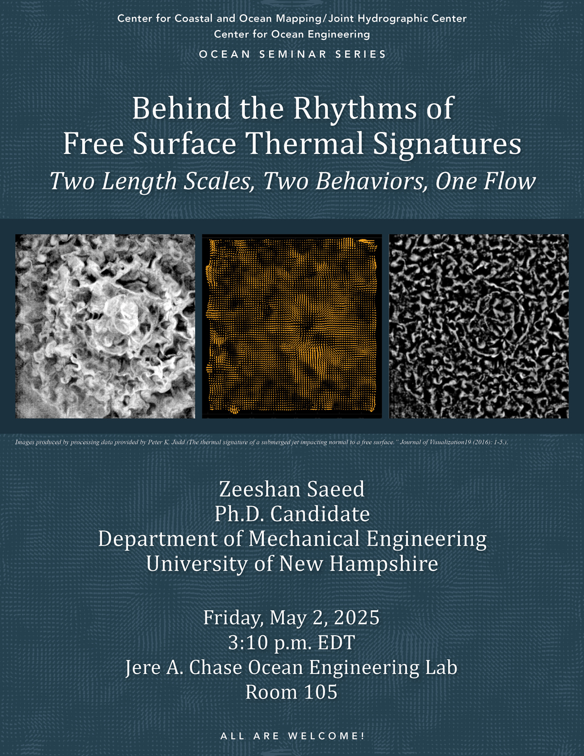 3:10pm - 4:10pm, Zeeshan SaeedPh.D. Candidate UNH Department of Mechanical EngineeringFriday, May 2, 2025, 3:10 p.m.Chase 105 AbstractFlows at the water surface, when
Center for Coastal and Ocean Mapping/Joint Hydrographic Center
- About Show About submenu
-
Research
Show Research submenu
-
Research Areas
Show Research Areas submenu
- Autonomous Systems
- AUVs
- Chart of the Future
- Coastal Processes
- Data Processing Show Data Processing submenu
- Data Visualization
-
Law of the Sea
Show Law of the Sea submenu
- All Reports
- Arctic Ocean Show Arctic Ocean submenu
- Atlantic Margin Show Atlantic Margin submenu
- Bering Sea - Beringian Margin Show Bering Sea - Beringian Margin submenu
- Bering Sea - Bowers Ridge Show Bering Sea - Bowers Ridge submenu
- Florida Escarpment Show Florida Escarpment submenu
- Gulf of Alaska Margin Show Gulf of Alaska Margin submenu
- Johnston Atoll, Pacific Ocean Show Johnston Atoll, Pacific Ocean submenu
- Line Islands, Kingman Palmyra, Pacific Ocean Show Line Islands, Kingman Palmyra, Pacific Ocean submenu
- Mariana Trench and West Mariana Ridge, Pacific Ocean Show Mariana Trench and West Mariana Ridge, Pacific Ocean submenu
- Mendocino Ridge, Pacific Ocean Show Mendocino Ridge, Pacific Ocean submenu
- Necker Ridge, Pacific Ocean Show Necker Ridge, Pacific Ocean submenu
- Sigsbee Escarpment Show Sigsbee Escarpment submenu
- Lidar
- Nautical Cartography Show Nautical Cartography submenu
- Seafloor Characterization
- Sonar Capabilities
- Water Column Mapping
- Research Projects Show Research Projects submenu
-
Research Areas
Show Research Areas submenu
-
Education
Show Education submenu
- FAQs
- CAT A Certificate
- Degree Programs
- Guidelines for Funding Applications
-
NF-GEBCO
Show NF-GEBCO submenu
- Program
-
Scholars
Show Scholars submenu
- Current GEBCO Scholars
- 2023-2024 GEBCO Scholars
- 2022-2023 GEBCO Scholars
- 2021-2022 GEBCO Scholars
- 2020-2021 GEBCO Scholars
- 2019-2020 GEBCO Scholars
- 2018-2019 GEBCO Scholars
- 2017-2018 GEBCO Scholars
- 2016-2017 GEBCO Scholars
- 2015-2016 GEBCO Scholars
- 2014-2015 GEBCO Scholars
- 2013-2014 GEBCO Scholars
- 2012-2013 GEBCO Scholars
- 2011-2012 GEBCO Scholars
- 2010-2011 GEBCO Scholars
- 2009-2010 GEBCO Scholars
- 2008-2009 GEBCO Scholars
- 2007-2008 GEBCO Scholars
- 2006-2007 GEBCO Scholars
- 2005-2006 GEBCO Scholars
- 2004-2005 GEBCO Scholars
- CCOM-SURF
- Outreach Show Outreach submenu
- Publications
- Resources Show Resources submenu